
Norman Channel Island & Guernsey HistoryLords Seigneurs of Gaule Lyonnaise King of Fiefs of Soissons and Brittany It has been considered that the island had occasional visits by hunting nomads as far back as 5,500 B.C. The tomb found at L’Ancresse has been dated circa 4,500 BC. It is a pre-megalithic grave that must be included among the oldest in Europe. Other remains of a fertility religion such as Dolmens and Menhirs are dated as far back as 4,000 and 3,000 B.C. The exact date when a permanent settler arrived to the island, probably in the form of a farmer with domestic cattle, sheep and goats as opposed to the seasonal nomadic hunter has not been completely established. During the first centuries (A.C.) the Bailiwick of Guernsey saw the Roman domination and collapse. It was
a part of the administrative unit based on Constantia (Countances), Province of <<Gallia Lugudensis
Secunda>>. The coming of Christianity is attributed to St. Martin de Tours, who died between 396 and 400 A.D.
After the Roman domination there followed a period of domination by Brittany and Franks and later frequent invasions by Norsemen. During the Carolingian period (751-987), the Frankish Kingdoms were divided into territories known as fiefs. The Carolingian Empire, established by Charlemagne, encompassed a vast area of Europe and was divided into several administrative units known as counties (or pagi) and duchies. The Carolingian rulers granted these territories to their loyal supporters, who in turn became the vassals of the king. King Alan the Great of Brittany (d. 907) waged war successfully on the Norsemen. As a result of his conquests, the Cotentin Peninsula was included theoretically in the territory of the Kingdom of Brittany, after the Treaty of Compiègne (867) with the king of the Franks. The exact distribution of fiefs varied over time and depended on the specific political and military circumstances of the Carolingian Empire. Some prominent fiefs and territories during this period included:
These are just a few examples of the fiefs that existed under the Frankish Kingdoms during the Carolingian period. The exact organization and distribution of fiefs were subject to change due to wars, alliances, and the shifting power dynamics of the time. https://en.wikipedia.org/wiki/Kingdom_of_Brittany The Charlemagne descendant King Louis the Pious suffered severe attacks from Norsemen in the 830s. The Norsemen caused great trouble to the Frankish King in Normandy (then known as Nuestria). The islands were ecclesiastically subordinated to the Bishop of Countances from the sixth century, but even this Bishop found it prudent for about a century to reside in Rouen as the pagan Norsemen so effectively subjugated the Cotentin region and near islands. It was not until 1049 that effective ecclesiastical control of Guernsey by the see of Countances could have been established. The islands come into English possession. The Norman period
However, we do know for sure that Guernsey, like its neighours Jersey and Alderney, is Old Norse-y: the –ey part – from Old Icelandic ey (gen. eyja, ‘island’) – leaves little room for doubt. That Guernsey and the other islands should have a Nordic origin comes as no surprise at all, considering that they became part of the Duchy of Normandy in 933, when the Duchy was created and granted to the Norseman Rollo. In the year 1020 Duke Richard II divided Guernsey diagonally in two halves, granting the east part to Neel, Vicomte of the Cotentin and the west part to Anchetel, Vicomte of the Bessin. In 1066 Duke William II conquered England becoming King William I of England. From that moment, the fate of the islands was linked to the English crown although a number of vicissitudes still had to pass before arriving at the current Islands status.
In 1204 King John lost Continental Normandy. This started a long period of disputes between France and England over the islands with frequent French raids over the archipelago. It also presented to the Seigneurs to the alternative of rendering homage to the King of France and thus losing the properties on the island or rendering homage to the King of England (now no longer Duke of Normandy), and thus losing their Continental properties. The islands were invaded by the French in 1338, who held some territory until 1345. Edward III of England granted a Charter in July 1341 to Jersey, Guernsey, Sark and Alderney, confirming their customs and laws to secure allegiance to the English Crown. Later, King Richard II of England reconfirmed in 1378 the Charter rights granted by his grandfather, followed in 1394 with a second Charter granting, because of great loyalty shown to the Crown, exemption for ever, from English tolls, customs and duties.
The islands after the King of England Lost the Normandy Dukedom
The Ceremony of Homage: Many Seigneurs still swear homage to the crown, directly to the King or to the King’s representative. It is performed three times a year at the Royal Court after St. Maurus’ day (January 15th), Easter Chief Pleas (Monday after Easter week) and after the Feast of St. Michael (Monday after Michael’s Day). This obligation holds only for the 17 seigneurs of certain fiefs at the time (XIII century) that the obligation began [*].
The XIV century was the time for five General Eyre and wars, including a French occupation of the Bailiwick (1338-1340) and the start of the 100 Years War. This conflict left some effects over the islands including the Castle-Cornet taken and re-taken by France and England. In 1360 by the Treaty of Bretigny France abandoned the claims to the islands in return for English recognition of the Bishop of Coutances. This dependence was interrupted during the Papal schism (1378-1417). Papal Neutrality to Island Fiefs
Recent Centuries
18th Century Grenadier's mitre worn by Thomas Le Patourel. The only known Guernsey Militia example to survive. Castle Cornet museum.
Today, The Channel Islands fall into two separate self-governing bailiwicks, the Bailiwick of Guernsey and the Bailiwick of Jersey. Both are British Crown dependencies, and neither is part of the United Kingdom. Guernsey has roughly 63,026 inhabitants and 23 private Ancient Fiefs. The Isle of Man and the Bailiwicks of Jersey and Guernsey are not part of Great Britain, they are not part of the United Kingdom and neither are they part of the European Union. They are self-governing British Crown dependencies Guernsey and the Channel Islands fall into two separate self-governing bailiwicks, the Bailiwick of Guernsey and the Bailiwick of Jersey. Both are British Crown dependencies, and neither is part of the United Kingdom. They have been part of the Duchy of Normandy since the tenth century, and Queen Elizabeth II is often referred to by her traditional and conventional title of Duke of Normandy. However, pursuant to the Treaty of Paris (1259), the Queen governs in her right as The Queen (the "Crown in right of Jersey",and the "Crown in right of the république of the Bailiwick of Guernsey"), and not as the Duke. This notwithstanding, it is a matter of local pride for monarchists to treat the situation otherwise: the Loyal Toast at formal dinners is to 'The Queen, our Duke', rather than to 'Her Majesty, The Queen' as in the UK
The Cotentin, conquered by Quintus Titurius Sabinus in 56 BC, [33] was divided between the pagus constantiensis ("County of Coutances") and the pagus coriovallensis ("County of Coriallo"), within Gallia Lugdunensis. Coriallo housed a small garrison and a castrum was built on the left bank of the Divette as an element of the Litus saxonicum, after Saxon raids at the beginning of the fourth century. [28] In 497, the village was sold with all of Armorica to Clovis. It was evangelised by Saint Éreptiole in 432, then by Saint Exuperat, Saint Leonicien, and finally Saint Scubilion in 555. [34] In 870, Saint Clair , landing in Kent, was ordained priest of Cherbourg and established a hermitage in the surrounding forest. [35] After several Norman raids in the ninth century, Cherbourg was attached to the Duchy of Normandy along with the Cotentin, in 933, by William Longsword. The Danish King Harold moved there in 946. In the face of English threats, Richard III of Normandy strengthened the fortifications of the castle at the same time as those of the other major strongholds of Cotentin. In 1053, the city was one of the four main cities of the duchy of William the Conqueror to receive an annuity in perpetuity for the maintenance of one hundred needy. [36] In 1139, during the struggle for succession to the Anglo-Norman Crown, Cherbourg fell after two months of siege to the troops of Stephen of England before being retaken in 1142 by Geoffrey of Anjou, whose wife, Empress Matilda, three years later founded the Abbaye Notre-Dame du Vœu . [35] During the conquest of Normandy by Philip II of France, Cherbourg fell without a fight in 1204. The city was sacked in 1284 and 1293, the abbey and the Hôtel-Dieu looted and burned, but the castle, where the population was entrenched, resisted. Following these ravages, Philip IV of France fortified the city in 1300. [35] Its strategic position, a key to the kingdom along with Calais as a bridgehead for invasion by the English and French, the town was much disputed during the Hundred Years' War. Having one of the strongest castles in the world according to Froissart, it changed ownership six times as a result of transactions or seats, never by force of arms. The fortress resisted the soldiers of Edward III in 1346. In February 1354, Cherbourg was transferred by John II of France to Charles II of Navarre with the bulk of the Cotentin. [37] The city was of Navarre from 1354 to 1378, and Charles II stayed in Cherbourg on several occasions. In 1378, the city was besieged by Charles V of France as the rest of the Norman possessions of the King of Navarre, but in vain. Navarre troops who had dropped the County of Évreux and the Cotentin were entrenched in Cherbourg, already a difficult taking, and defended it against French attacks. [38] In June 1378, having lost ground in Normandy, Charles II of Navarre rented Cherbourg in 1378 to Richard II of England for a period of three years. Bertrand du Guesclin besieged it for six months using many machines of war, but abandoned the siege in December 1378. [39] The King of England then refused to return the city to the Navarrese, despite the efforts of Charles II. It was only his son Charles III of Navarre who recovered it in 1393. In 1404, it was returned to Charles VI of France, in exchange for the Duchy of Nemours. [40] Fallen in 1418 to the hands of the English, Cherbourg, the last English possession of the Duchy of Normandy after the Battle of Formigny, was released on 12 August 1450. [35] On 28 April 1532, Cherbourg was visited with great fanfare by Francis I and the dauphin. [35] At that time, Cherbourg was described by Gilles de Gouberville as a fortified town of 4,000 residents, protected by drawbridges at the three main gates which were permanently guarded and closed from sunset until dawn. Inside the city walls, the castle, itself protected by wide moats and equipped with a keep and twelve towers, was south-east of the city. Outside and to the south of the city walls, the suburb along the Divette was frequented by sailors. [41] Cherbourg was not affected by the wind of the Reformation that divided Normandy, consolidated and heavily guarded by Matignon , Henry III thanked his defence against the troops of Montgomery, as lieutenant-general of Normandy and Governor of Cherbourg in 1578, and then marshal the following year. The bourgeois also remained loyal to Henry III and Henry IV, when Normandy was mostly held by the Catholic League. [35]
Roman Armorica [edit ]The peninsula formed part of the Roman geographical area of Armorica. The town known today as Coutances, capital of the Unelli, a Gaulish tribe, acquired the name of Constantia in 298 during the reign of Roman emperor Constantius Chlorus. The base of the peninsula, called in Latin the pagus Constantinus, joined together with the pagus Coriovallensis centred upon Cherbourg to the north, subsequently became known as the Cotentin. Under the Carolingians it was administered by viscounts drawn successively from members of the Saint-Sauveur family, at their seat Saint-Sauveur on the Douve. [6]
Cotentin Peninsula - Wikipedia
Lord Seigneur of Gaule Lyonnaise
County of Coriallo Gallia Lugdunensis (French : Gaule Lyonnaise ) was a province of the Roman Empire in what is now the modern country of France , part of the Celtic territory of Gaul formerly known as Celtica . It is named after its capital Lugdunum (today's Lyon ), possibly Roman Europe's major city west of Italy, and a major imperial mint. Outside Lugdunum was the Sanctuary of the Three Gauls , where representatives met to celebrate the cult of Rome and Augustus.
HistoryIn De Bello Gallico describing his conquest of Gaul (58–50 BC), Julius Caesar distinguished between provincia nostra in the south of Gaul, which already was a Roman province in his time, and the three other parts of Gaul: the territories of the Aquitani, of the Belgae, and of the Galli also known as the Celtae. The territory of the Galli extended from the rivers Seine and Marne in the north-east, which formed the boundary with Gallia Belgica, to the river Garonne in the south-west, which formed the border with Gallia Aquitania. Under Augustus, Gallia Lugdunensis was created by reducing in size the territory of the Galli: the portion between the river Loire and the Garonne was given to Gallia Aquitania, and central-eastern portions were given to the new province of Germania Superior. The map shows the extent after these reductions. The date of the creation of Gallia Lugdunensis is under discussion, whether between 27 and 25 BC or between 16 and 13 BC, during Augustus' visits to Gaul.
The Kingdom of Brittany [edit ]At the beginning of the medieval era, Brittany was divided among three kingdoms, Domnonea, Cornouaille and Broërec. These realms eventually merged into a single state during the 9th century. [26] [27] The unification of Brittany was carried out by Nominoe, king between 845 and 851 and considered as the Breton Pater Patriae. His son Erispoe secured the independence of the new kingdom of Brittany and won the Battle of Jengland against Charles the Bald. The Bretons won another war in 867, and the kingdom reached then its maximum extent: It received parts of Normandy, Maine and Anjou and the Channel Islands.
History [edit ]Roman Armorica [edit ]The peninsula formed part of the Roman geographical area of Armorica. The town known today as Coutances, capital of the Unelli, a Gaulish tribe, acquired the name of Constantia in 298 during the reign of Roman emperor Constantius Chlorus. The base of the peninsula, called in Latin the pagus Constantinus, joined together with the pagus Coriovallensis centred upon Cherbourg to the north, subsequently became known as the Cotentin. Under the Carolingians it was administered by viscounts drawn successively from members of the Saint-Sauveur family, at their seat Saint-Sauveur on the Douve. [6] Medieval history [edit ]King Alan the Great of Brittany (d. 907) waged war successfully on the Norsemen. As a result of his conquests, the Cotentin Peninsula was included theoretically in the territory of the Kingdom of Brittany, after the Treaty of Compiègne (867) with the king of the Franks. The kings of Brittany suffered continuing Norse invasions and Norman raids, and Brittany lost the Cotentin Peninsula (and Avranchin nearby) after only 70 years of political domination. Meanwhile, Vikings settled on the Cotentin in the ninth and tenth centuries. There are indications of a whaling industry there dating to the ninth century, possibly introduced by Norsemen. [7] They were followed by Anglo-Norse and Anglo-Danish people, who established themselves as farmers. The Cotentin became part of Normandy in the early tenth century. Many placenames there are derived from the Norse language. Examples include La Hague, from hagi ("meadow" or "enclosure"), and La Hougue, from haugr ("hill" or "mound"). [8] Other names are typical: all those ending with -tot (Quettetot..) from topt "site of a house" (modern -toft), -bec (Bricquebec, Houlbec..) from bekkr "brook", "stream", etc. In 1088 Robert Curthose, Duke of Normandy, enfeoffed the Cotentin to his brother Henry, who later became king of England. Henry, as count of the Cotentin, established his first power base there and in the adjoining Avranchin, which lay to the south, beyond the River Thar. [9] During the Hundred Years War, King Edward III of England landed in the bay of La Hougue, and then went to the Church of Quettehou in Val de Saire. It was there that Edward III knighted his son Edward, the Black Prince. A remembrance plaque can be seen next to the altar.
Avranchin History [edit ]Avranchin was once the territory of the Abrincuti. During Roman rule it became part of the second division of Gallia Lugdunensis, which roughly corresponds to modern-day Normandy. After the fall of the Roman empire the area became part of the Frankish kingdom of Neustria until it was ceded to Brittany as part of the treaty of Compiègne in 867. In 933 William Longsword was given control of a large part of Brittany (Avranchin included) in return for recognizing Rudolph of France as king of West Francia. The Bretons did not recognize this agreement and had to be forcibly suppressed. Avranchin was not fully integrated into Normandy until 1009 under Richard II. In 1204 Phillip II took Normandy (and alongside it Avranchin) for France. Modern history [edit ] Cotentin Peninsula - WikipediaThe naval Battle of La Hogue in 1692 was fought off Saint-Vaast-la-Hougue near Barfleur. The town of Valognes was, until the French Revolution, a provincial social resort for the aristocracy, nicknamed the Versailles of Normandy. The social scene was described in the novels of Jules Barbey d'Aurevilly (himself from the Cotentin). Little now remains of the grand houses and châteaus; they were destroyed by combat there during the Battle of Normandy in World War II. During World War II, part of the 1944 Battle of Normandy was fought in the Cotentin. The westernmost part of the D-Day landings was at Utah Beach, on the southeastern coast of the peninsula, and was followed by a campaign to occupy the peninsula and take Cherbourg. The genetic history of the modern inhabitants of Cotentin Peninsula is being studied by the University of Leicester to determine the extent of Scandinavian ancestry in Normandy. [10]
The Kingdom or Domain of Soissons [2] was a rump state of the Western Roman Empire in northern Gaul, between the Somme and the Seine, that lasted for some 25 years during Late Antiquity. The rulers of the rump state, notably its final ruler Syagrius, were referred to as "kings of the Romans" (Latin: rex Romanorum) by the Germanic peoples surrounding Soissons, with the polity itself being identified as the Regnum Romanorum, " Kingdom of the Romans", by the Gallo-Roman historian Gregory of Tours. Whether this title was used by Syagrius himself or was applied to him by the barbarians surrounding his realm in a similar way to how they referred to their own leaders as kings is unknown. [3] "Kingdom (or Domain) of Soissons" is a later, historiographical term for the state. The Kingdom of Soissons began when Emperor Majorian (457–461) appointed Aegidius as magister militum of Roman Gaul. When Majorian was killed on the orders of Ricimer in 461, Aegidius maintained his own rule in the remnants of Roman Gaul. In the chaos of contemporary Gaul, he maintained his power against Franks to his east and Visigoths to his south. Aegidius died in 464 or 465. His son Syagrius succeeded to the rule. In 486, Syagrius lost the Battle of Soissons to the Frankish king Clovis I and the domain was thereafter under the control of the Franks.
Roman Empire: The Channel Islands, like much of Western Europe, were part of the Roman Empire. They were likely inhabited by Gaulish tribes and came under Roman control during the Roman conquest of Gaul in the 1st century BC. Viking Invasions: In the 9th and 10th centuries, Viking raiders and settlers, primarily from Scandinavia, began to establish a presence in the Channel Islands. They formed small Norse communities and exerted influence over the islands. Duchy of Brittany: During the Viking period, the Duchy of Brittany, which encompassed present-day Brittany in France, had some level of control or influence over the Channel Islands. Norman Conquest: In 1066, William the Conqueror, Duke of Normandy, successfully invaded England and became the King of England. As a result, the Channel Islands, including Guernsey and Jersey, came under the rule of the Norman and subsequent Angevin kings, who held both the Duchy of Normandy and the Kingdom of England. It was under the Angevin kings, particularly Henry II and his successors, that the Channel Islands became more closely associated with England and the English Crown. The Angevin dynasty maintained control over the Channel Islands until the loss of mainland Normandy to France in 1204, after which the islands remained under the English Crown as separate entities known as the Crown dependencies.
|
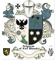
Seigneur de la Fief of Blondel Lord Baron Mentz of Fief Blondel Geurnsey Crown Dependency Seigneur Fief of Blondel George Mentz Lord Baron of Fiefdom Blondel Freiherr of Fief Thomas Blondel Feudal Lord of Baronnie - Noble Fief Barony Friherre > Channel Island History Seigneur de la Fief of Blondel Lord Baron Mentz of Fief Blondel Geurnsey Crown Dependency Seigneur Fief of Blondel George Mentz Lord Baron of Fiefdom Blondel Freiherr of Fief Thomas Blondel Feudal Lord of Baronnie - Noble Seigneurs and Dames Travel Research Lord Paramount Feudal Barons The Seigneur Order Patron George Mentz Charter of Liberties Deed & Title Fief Blondel Islands Viking Kingdom Fief Worship Fiefs of the Islands ECS Extended Continental Shelf Styles and Dignities Territorial Waters Blondel Privy Seal Fief Bouvees of Fief Thomas Blondel Guernsey Court of Chief Pleas Fief Court Arms Motto Flower Fief de l'Eperon La Genouinne Kingdom of West Francia Fief DuQuemin Bouvée Phlipot Pain Bouvée Torquetil Bouvée Bourgeon Bailiwick of Ennerdale Channel Island History Fief Direct from the Crown A Funny Think Happened On the Way to the Fief Guernsey Bailiwick of Guernsey - Crown Dependency Confederation des Iles Anglo-Normandes Sovereignty Papal Bull Research Links Norse Normandy Order of the Genet Order of the Genet Order of the Star Est. 1022 Knights of theThistle of Bourbon Count of Anjou Fief Rights Blondel and King Richard Press Carnival Manorial Incidents Appointments of Seigneurs Store Portelet Beach Roquaine Bay Neustrasia Columbier Dovecote Fief Blondel Merchandise Fief Blondel Beaches Islands Foreshore Events Fiefs For Sale Sold Lords of Normandy Fief Coin Viscounts de Contentin Fief Blondel Map Feudal Guernsey Titles Board of Trustees The Feudal System Hereditaments Chancellor Flag & Arms Fief Videos Guernsey Castle Sark Contact Advowson Site Map Disclaimer Freiherr Livres de perchage Lord Baron Longford Income Tax Guernsey Valliscaulian Order Saint Benedict of the Celestines Society of Divine Compassion Dictionary Count of Mortain Seigneur de Saint-Sauveur Seigneur of Fief Ansquetil Top Success Books Datuk Seri George Mentz Order St. Benedict OSB Celestines Order of the Iron Crown Order of the White Falcon Colonel Mentz Order Red Eagle Order St. Louis Order Holy Ghost Order of Saint Anthony Order of the Black Swan Order of St Columban Order of the Iron Helmet Livonian Brothers of the Sword Fief treizième and Direct from Crown Valuation Fief Blondel Prince of Annaly Teffia
Feudal Lord of the Fief Blondel of the Nordic Channel Islands Guernsey Est.
1179
Feudalherr - Fief Blondel von der Nordischen Insel Guernsey Est. 1179
New York Gazette - Magazine of Wall Street -
George Mentz -
George Mentz - Aspen Commission - Mentz Arms
Counselor George Mentz Esq. - Seigneur Feif BlondelBaron Annaly Baron Moyashel Grants to Delvin About Longford Styles and Dignities The Seigneur Court Barons Fiefs of the Islands Longford Map The Island Lords Market & Fair Fief Worship Channel Island History Fief Blondel Lord Baron Longford Fief Rights Fief Blondel Merchandise Events Blondel and King Richard Fief Coin Feudal Guernsey Titles The Feudal System Flag & Arms Castle Site Map Disclaimer Blondel Myth DictionaryMentz Scholarship Program 101 Million Donation - Order of the Genet Knighthood |
George Mentz Education -
Commissioner George Mentz
-
https://finance.yahoo.com/news/commissioner-george-mentz-clinches-influencer-180000705.html
-
George Mentz News -
George Mentz Net Worth - George Mentz Noble Tilte -
George Mentz -
George Mentz Trump Commissioner -
George Mentz Freiherren Count Baron -
George Mentz Global Economic Forum -
George Mentz Donates Millions


